
European Travels: From Stralsund to Usedom – Exploring 2 German Baltic Islands
 Continuing on our tour of the Baltic cities: leaving Rostock in the direction of Stralsund, we again decided to take the slow road.
We had read that three small islands linked to the mainland and each other by bridges - Fischland, Darss, and Zingst – cover a good part of the Baltic coastline between the cities of Rostock and Stralsund.
We had hoped to see some of the 60,000 or more cranes that arrive every fall on the island of Zingst, but the weather did not cooperate: It rained.
The long beaches were deserted; the reed fields along the eastern inland coastline of Fischland - which at some parts is only about 600 feet wide - swayed sadly in the driving rain; Ahrenhoop, a favorite of artists since the end of the 19th century, showed no life.
Fortunately, by the time we reached Stralsund, the rain had become just a drizzle.
The second and third parts of this video: "Ostsee: Lübeck, Stralsund, Rügen, Hiddensee," from the Mediathek archive of “Das Erste,” the German TV channel, show some wonderful images of Stralsund and the island of Rügen.
Stralsund
Stralsund became an important Hanse city Hamburg to Wismar for more about the “Hanse”) when it joined the League in 1293. Today it has about 58,000 inhabitants.
 Together with that of Wismar, Stralsund's historical core is a UNESCO World Heritage site and the many imposing brick gothic buildings still give testimony to the city's former wealth.
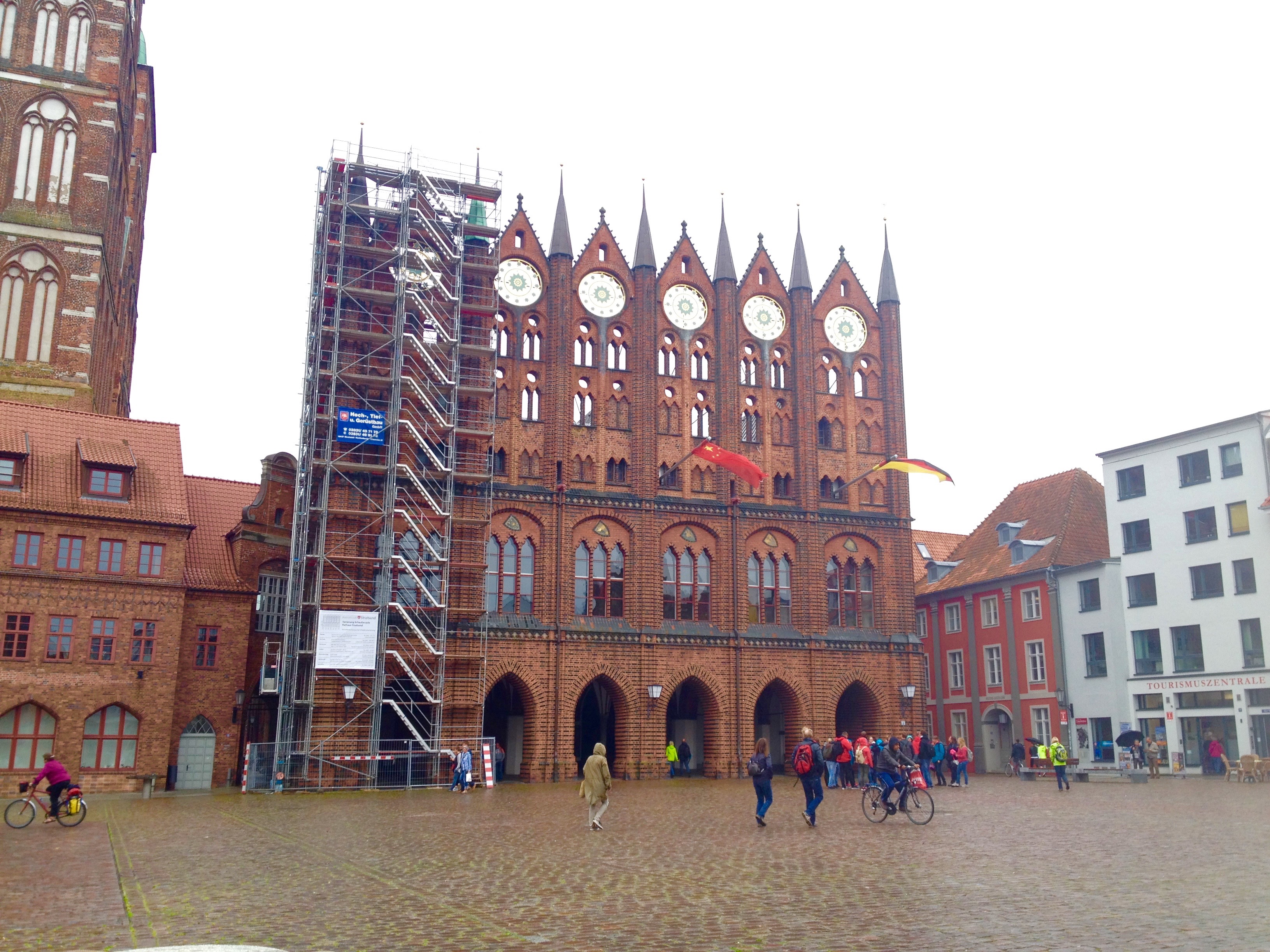
The old market square (“Alter Markt”) is surrounded by buildings from different periods: the Gothic Town Hall (13the century), see picture above, the imposing St. Nicholas church (“Nikolaikirche”) completed in the 14th century, and the 18th century Commandantenhus.
 Our walk through the old city core made it clear why Stralsund had been of such strategic importance: It is surrounded by water on three sides.
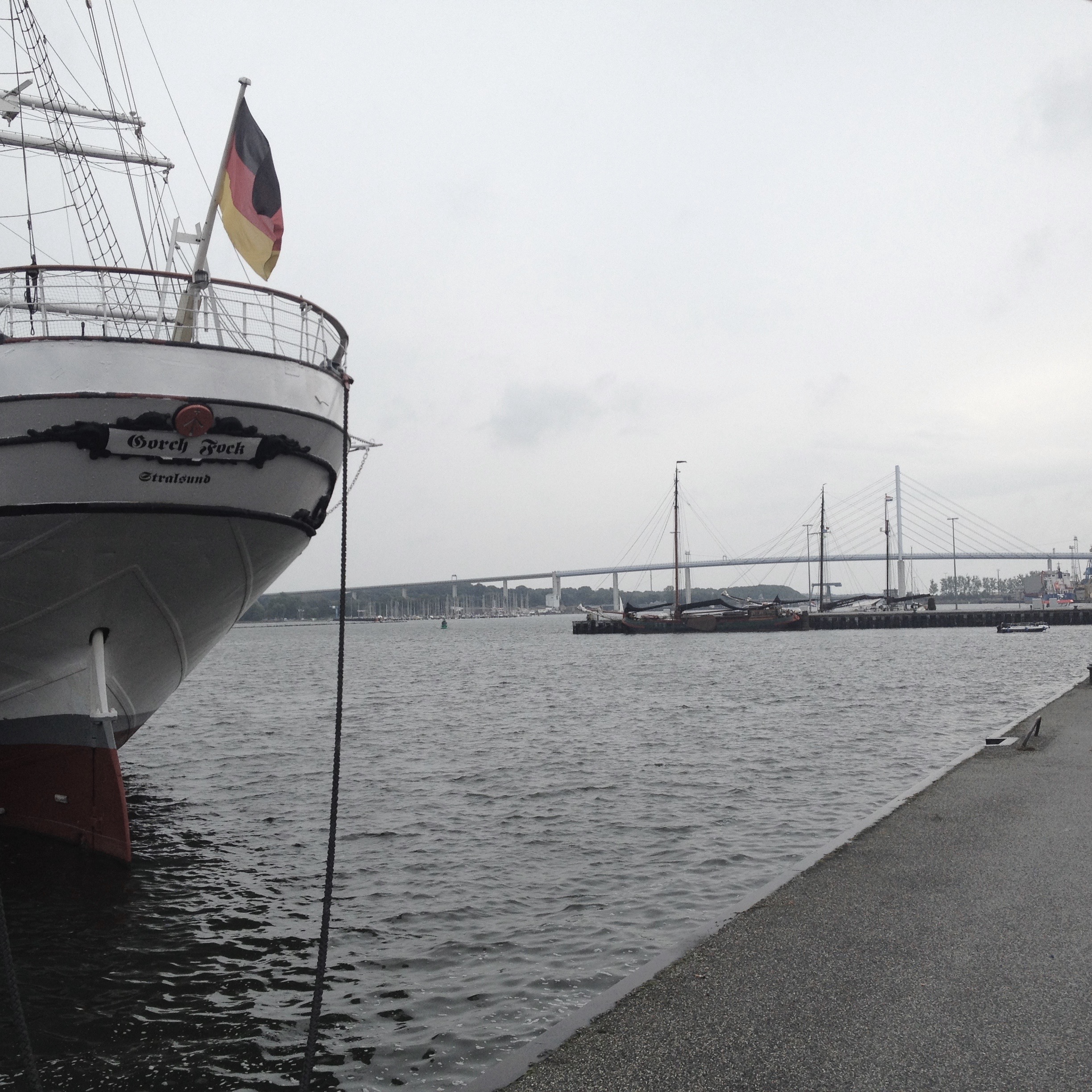
At the harbor, we admired the Gorch Fock 1, the German Navy's former training ship, which is now a floating museum.
And from the harbor we could also see the new suspension bridge, which has connected Rügen, Germany's largest island, with the mainland since 2007. (see picture)
Rügen
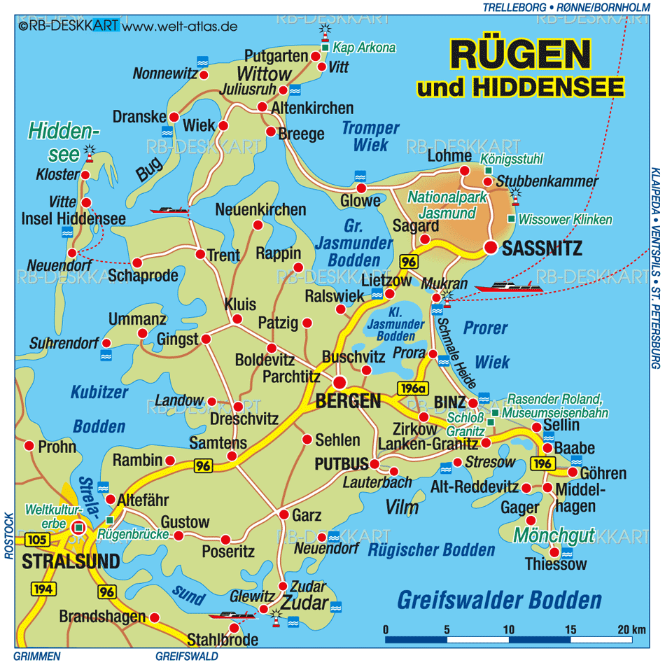
As the map shows, Rügen is a large island with many lagoons (“Bodden”). I always wanted to visit Rügen,as I remember my father talking about the island.
 aHe had wonderful memories of the vacations he spent there with his family in the 1920ties, at which time they lived in Berlin. I recalled him mentioning the town of Sassnitz, and so we decided to stay there for a few days.
SASSNITZ
(A linguistic tidbit: When Germany introduced a spelling revision in the early 90's, the original spelling of the town “Saßnitz” was then changed to “Sassnitz” in 1993. This was consistent with changing the “ß” to “ss” after short vowels.
So, words that used to be spelled daß, naß, muß, Kuß, etc. changed their spelling to dass, nass, muss, Kuss, etc. The “ß” after long vowels in words such as Gruß, saßen, schließen, etc., was kept.)
 Sassnitz, a town with less than 10,000 inhabitants, lies on the northeast corner of the island at the edge of the Jasmund National Park.
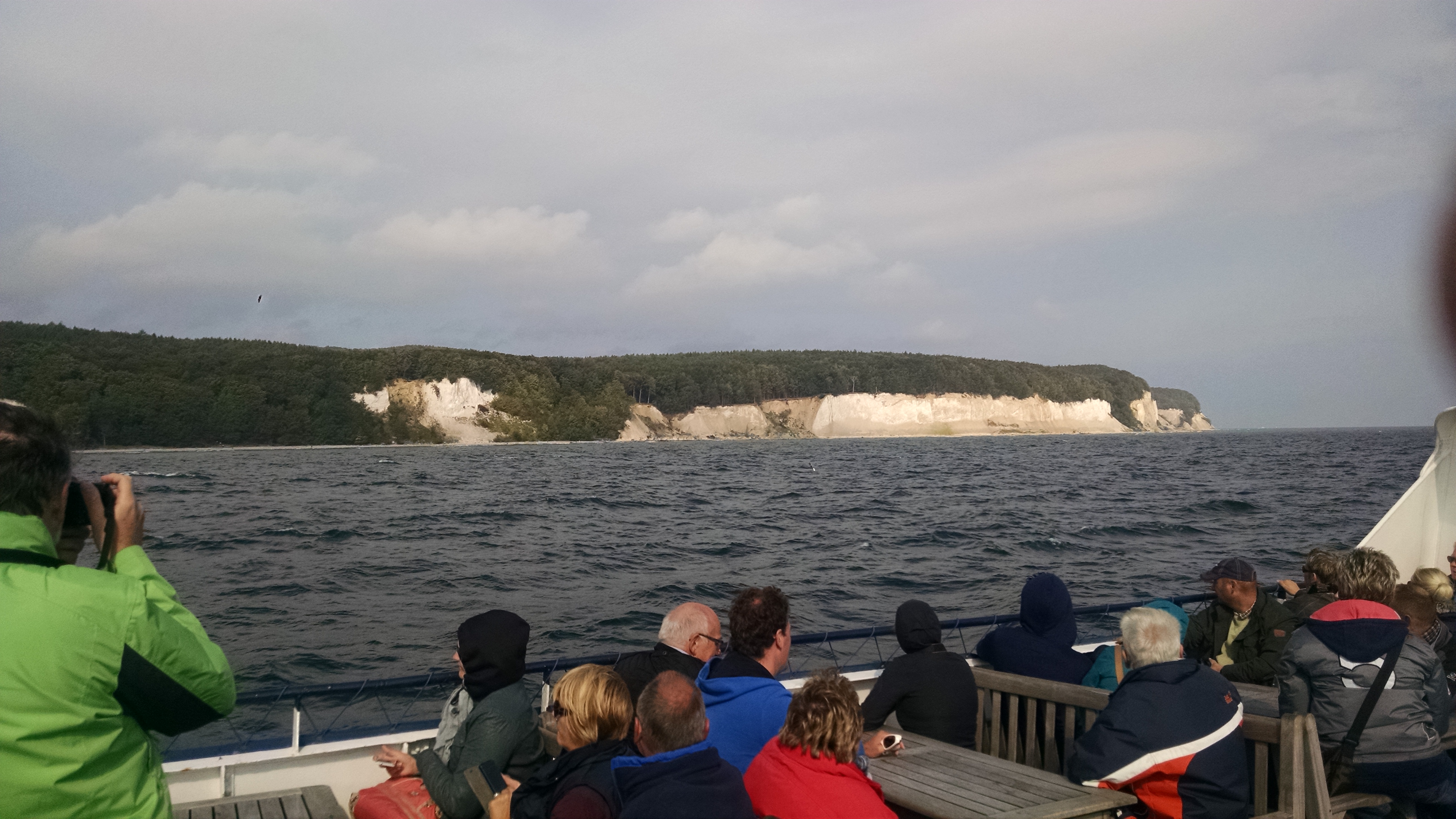
One of the attractions of the park is the Königsstuhl (king's chair), an over 350 ft high chalk cliff designated as a World Heritage site.
To see the famous chalk cliffs, we chose a boat trip, which took us from Sassnitz north along the coast. We not only saw the Königsstuhl and the adjacent chalk cliffs in the gleaming sunlight, but also heard much about Sassnitz' history.
When a rail link to Bergen, Rügen's main city in the center of the island, was established in 1891, the little fishing village of Sassnitz started growing and the chalk industry expanded.
When the beach promenade was built in the early 1900s, tourism grew as well.
Later, during GDR times, the harbor was home to a large fishing fleet and a ferry terminal with service to Russia and Poland.
In 1984, the ferry terminal was relocated a few miles south to the subdistrict of Mukran, to operate a railway ferry to the Soviet Union. Today,the new and expanded ferry terminal in Mukran (see picture) is Germany's most easterly deep water port and has developed into a trading and transport hub for Scandinavia, Russia, the Baltics and former Soviet Union states.
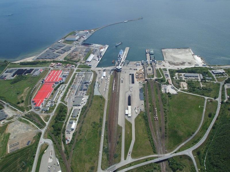
Because it is the only port in western Europe with track and transshipment facilities for Russian broad-gauge vehicles, it's often called “the most westerly station on the Trans-Siberian railway.”
However, the relocation of the ferry terminal and the decline of the fishing fleet after reunification, have made the large, well-protected harbor in Sassnitz look quite empty.
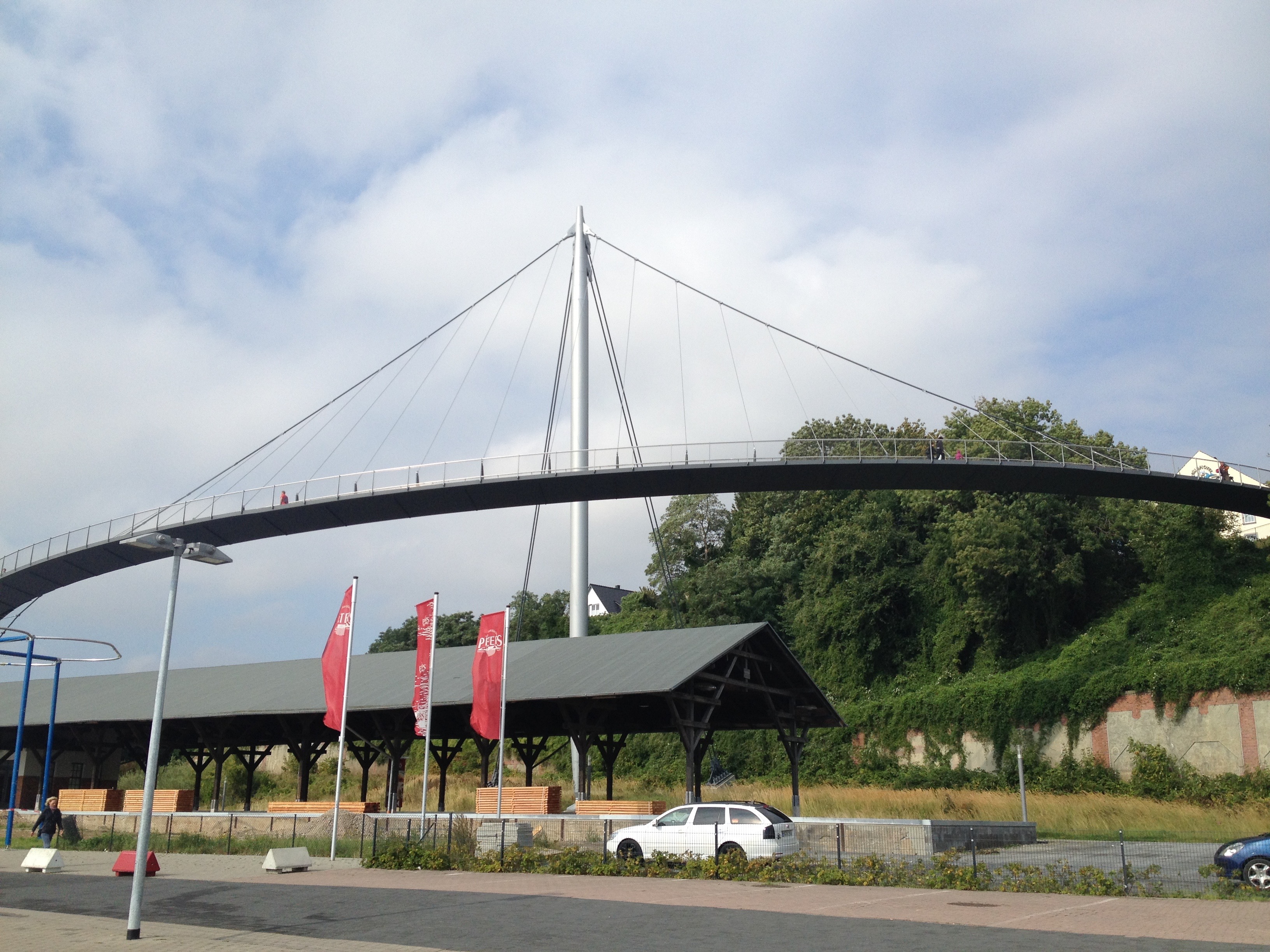 The town is making great efforts to attract more tourism. Some of the old hotels have been renovated and a very impressive pedestrian suspension bridge connects the harbor to the upper town (see picture).
We had rented an apartment in the upper part of town in a private residence, whose garden extended to a cliff that dropped directly down to the Baltic sea. Our landlady lived with her harbormaster husband in the downstairs apartment.
We frequently chatted with her; she was very helpful, gave us advice on restaurants and walking tours, and even brought us a plate of homemade “Pflaumenkuchen mit Schlagsahne” (plum pie with whipped cream) on Sunday afternoon.
She also told us a story that still bothers her today – 25 years after the fall of the GDR: In the mid-eighties, when travel restrictions between East and West Germany were somewhat eased for older people, she wanted to visit one of her sisters, who lived in Hamburg.
In order to get the necessary exit Visa she had to go to Stralsund to be officially interviewed.
“I will never forget this woman” she said. “I come from a large family with four brothers and three sisters, some of them I had not seen in years. She wanted to know why my sister Jutta, who lived near Berlin, had never asked to go to West Germany. How would I know?! This woman knew where all my sisters and brothers, even where my cousins lived and where they had traveled to. She knew more about my family than I did. It was really scary.”
PRORA
We had never heard of Prora until a Swedish couple we met in Lübeck suggested that we visit the site.
Only a short drive south fromSassnitz, we passed the huge new train/ferry terminal of Mukran and then stopped along a long beautiful white beach, which stretches all the way to the next, larger town, Binz.
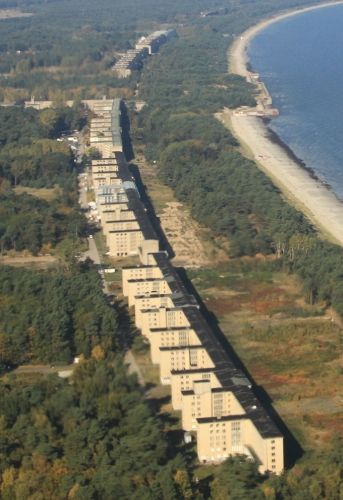 Prora is one of these gigantic projects that Hitler had started in 1936, but never completed. As envisioned by him and his planners, this seaside resort for the Nazi organization “Kraft durch Freude” (KDF, meaning Strength through Joy) was intended to accommodate 20,000 vacationers.
The complex of buildings stretches for several miles along one of Rügen's most beautiful beaches and can be best appreciated from the aerial photo (right) and other maps and pictures on the Prora website. There you can also learn more details about the gigantic project that sprang out of the ground in only three years.
When the war began, construction was halted and after the war, the buildings were initially used by the Soviet army and later by the East German army.
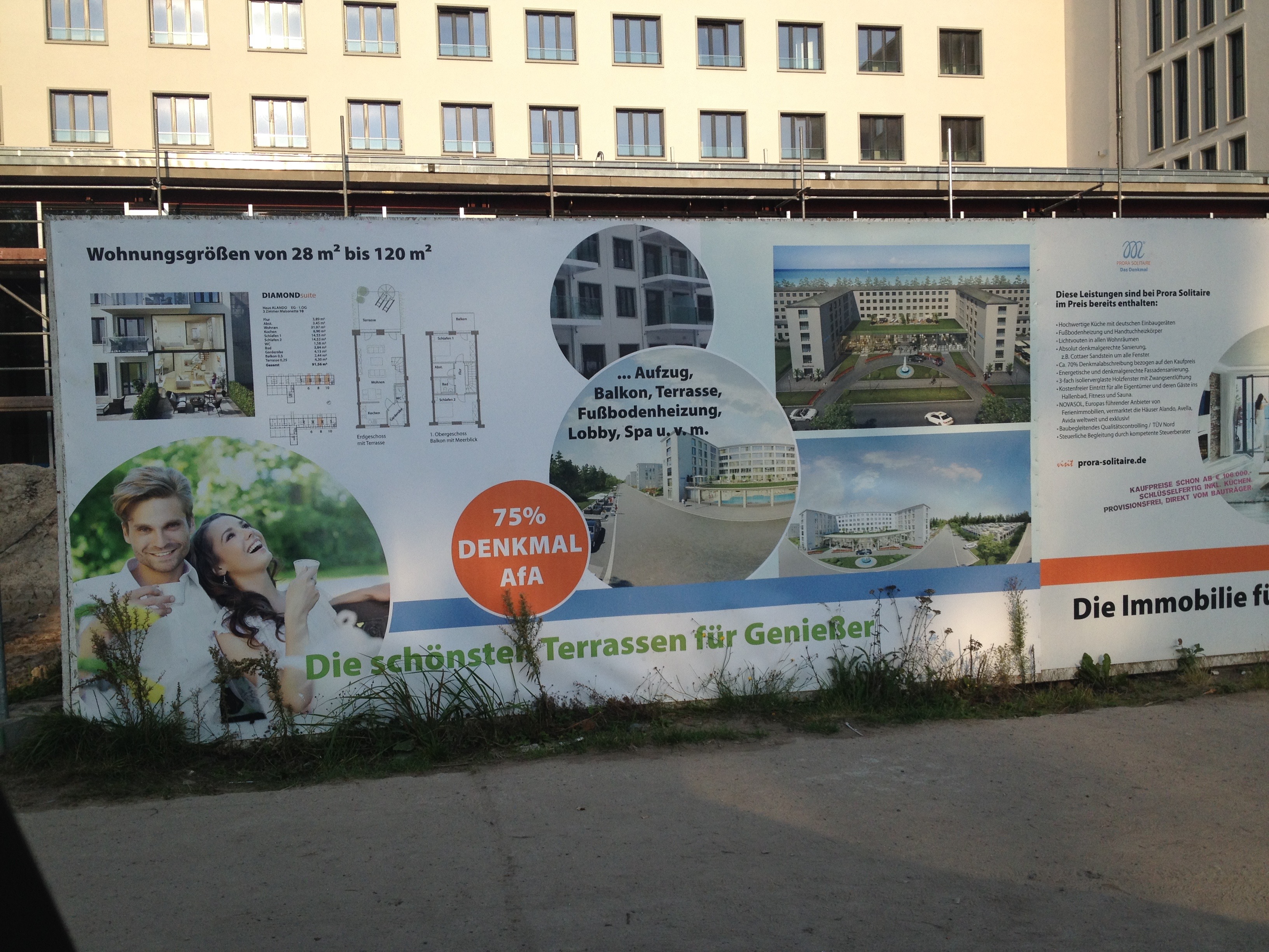 Today, some of the buildings have already been renovated and are used as the Prora Documentation Center, a youth hostel, a coffee shop, and most recently apartments.
So, nearly 80 years after construction started, and after decades of inaction and shame about its Nazi past, the “New Prora” complex is gradually being turned into luxury condominiums. (see picture)
After a few days of exploring Rügen – and there are more sights, places, beaches, towns, etc. to explore than we can cover here - we headed further southeast to another island - Usedom.
Usedom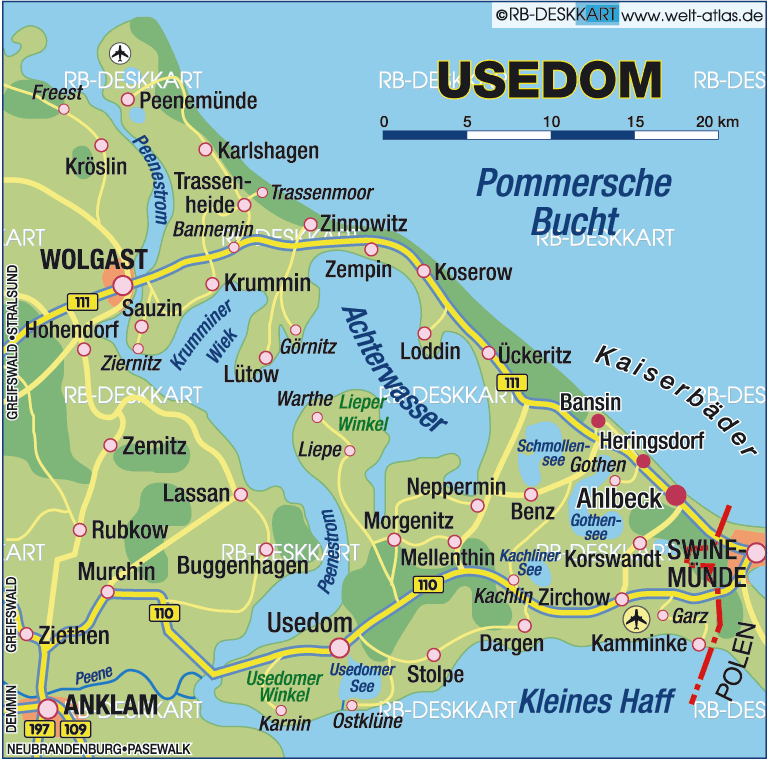
Usedom is Germany's second biggest usland, and maybe even more so than Rügen, has again become “die Badewanne der Berliner” (the bathtub of Berliners) as it had been during the 1920s and 1930s. (And I, indeed, remember my father reminisce about Usedom as well.)
But I also knew of Usedom as the site of another notorious Nazi installation: Peenemünde. After Hitler came to power in 1933, this place became the world's most advanced center of rocket science research in only a few years.
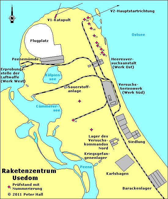
PEENEMÜNDE
Peenemünde is located at the northern, narrow tip of the island, separated from the mainland by a wide channel. This very location also explains why the research could be kept secret for so long.
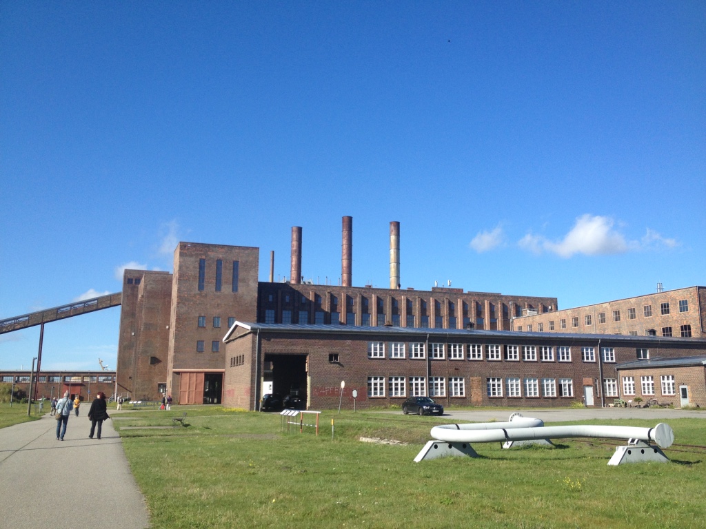 Our visit to the Historical Technical Museum, located in the observation bunker and former power station, (see picture left) was both interesting and depressing:
Interesting, because the exhibition explained the many stages of rocket development between 1932 and 1945, as well as in later years.
Interesting, because I did not know, for example, how instrumental Wernher von Braun had been not only in the research, but also in the development of the immense research and rocket production center.
Interesting, because I did not realize that, until the start of the war in 1939, scientists and workers from all over Europe were hired and came to Peenemünde.
Interesting, because I wonder, how the “distribution” of the Peenemünde scientists among the four allied powers after the war was still able to give the Soviet Union a head start in the space race - when the US was drafting the top brass;
Depressing, because of the damage and terror the V2 rockets caused, especially in England.
Depressing, because the German scientists, (including Wernher v. Braun) were successful in convincing the Nazi leadership after 1933 that more funding of rocket research would have military benefits.
 Depressing, because once the war started, Peenemünde became a prison for foreign scientists and workers, and KZ inmates and other prisoners were used as forced laborers.
Depressing, because Allied bomb raids seemed to have killed prisoners and forced laborers rather than destroying the launching facilities, etc. etc.
The scale of the original Peenemünde research and production center can only be understood by looking at maps and aerial photographs.
Except for the power station and observation bunker (shown on the picture above and only a small part of the facility), most other facilities were destroyed after the war.
Dreikaiserbäder
After the interesting but also sobering visit to Peenemünde, we drove south towards the “Dreikaiserbäder” (Three baths of the emperor), the towns of Bansin, Heringsdorf, and Ahlbeck. They were favorites of German emperors until 1918.
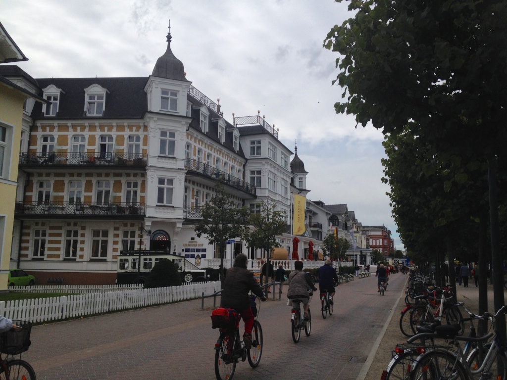 As we were looking for a hotel along the beachfront, we realized that these three towns are actually connected by an over 7-mile-long beach promenade.
The beach and “Dünenstraße” (dune road) actually extends beyond the border with Poland, into the former Swinemünde, now Swinoujscie. (After World War 2, the southeast tip of Usedom, including Swinemünde, was awarded to Poland.)
We found a hotel in Heringsdorf, located directly at the promenade and enjoyed the pleasures of beach life for a couple of days.
We took long walks along the wide beach. (To do this, we had to acquire a “Kurpass” for 3 euros each).
At one of these concerts, we shared a table with a young couple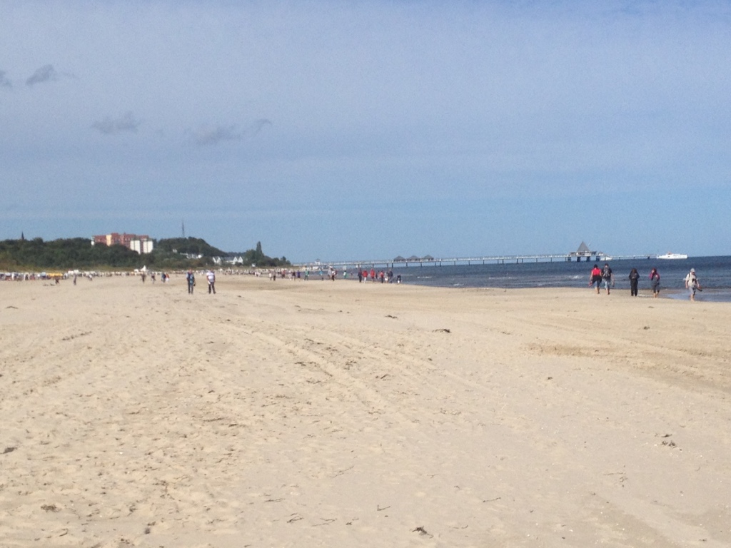 . (It's very typical in German beer gardens and restaurants to share tables.) We learned that they lived in Lübeck, a city we had just visited.
We asked them what attracted them and their two young twin daughters to the Usedom beaches, rather than to the “Timmendorfer Strand,” the well-know beach in Travemünde near their home.
“The Timmendorfer Strand is overrun by folks from Hamburg!” they answered. “And the beaches are cleaner and safer here, so our girls can play without us worrying.” (see picture of Heringsdorf Beach)
Their answer provided us with another insight and understanding why the Baltic sea beaches, with their low tides and beautiful white sand, are more attractive to beachgoers than the mudflats of the German North Sea with their 12-16 foot tides.
With our stay in Heringsdorf, we've come to the end of our trip along the German Baltic coast. The next destination, Berlin, will be the topic of our next travel post.
Bio: Ulrike & Peter Rettig are co-founders of Gamesforlanguage.com. They are lifelong language learners, growing up in several European countries before moving to Canada and the United States. You can follow them on Facebook, Twitter and Instagram, and leave any comments with contact.